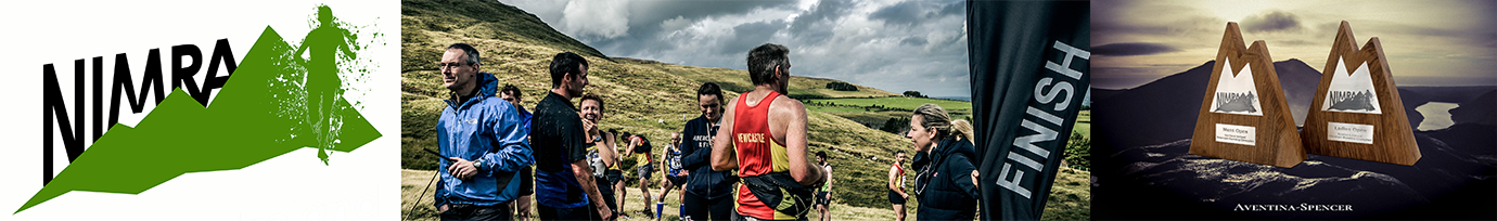
Annalong Horseshoe (C)
Race 3 in the NIMRA Championship
Category: Long
Distance: 13.1 miles (21.1 km)
Climbing: 1550 metres climb
START and FINISH: Dunneywater, Head Road, Annalong, Mournes map ref 357223
Checkpoints
Start, Rourke’s Park 358223
Chimney Rock 364257
Commedagh (cairn) 346286
Cove 336270
Slievelamagan 329260
Binnian 320234
Finish at Dunneywater 357223
On descending the track from Binnian, you must continue down the main track to the road at the Carrick Little car park (345219) , you are not allowed to cut the corner.
Apart from visiting the above checkpoints and the above restriction on the descent ftom Binnian, the route choice is yours. While checkpoints are on the above tops, the marshals will normally be on the cols between tops to oversee the safety of the race better.
Route Description
The following route description is for guidance only.
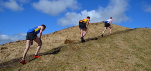
After the start go East along the road for 30 yards, then left up the lane to the Mourne Wall. There you can either keep to the outside of the wall towards Long Seefin or continue on, cross the stile and pick up the track on the map, crossing the wall on the shoulder between Rocky and Long Seefin. Cross to Chinney Rock, climbing on heather to its south ridge where a path can be picked up taking runners to the summit. Aim for the north west tors, probably passing them on the north side and pick up descending paths towards the Mourne Wall. Then vear north towards the stile where the Brandy Pad crosses the Wall. Along the Brandy Pad cutting up to the Saddle and then to Commedagh Cairn. South west from the cairn, past the tower & over the stile to descent steep ground to the col before Slieve Beg. Over ther shoulder of Slieve Beg (no need to go to the top unless you want to stay on paths) to climb the path to Cove summit, well out to the left. A fast descent follows with a short climb to Lamagan. The descent from Lamagan is rough and is followed by a long climb up the well used track on the north ridge of Binnian. If your endurance is not great, this is where you will realise it! Contour along the ridge, keeping to the east of most of the tors, with the checkpoint on the high flat ground a few feet below the rocky summit of Binnian. Continue south off this to the small gap between the tors (where the Hill & Dale race finishes) and then turn east to descend with the wall on your right all the way to the track returning you to Carrick Little car park. Then fast along the road for almost a mile, with a short sprint uphill to the finish.
Registration
Registration will be at Dunneywater between 9.30 -10-30 on race day where runners will receive their race numbers and hired ‘dibbers’. All runners will have their kit checked by race organisers prior to the start.
Equipment
All runners must carry;
a) Whistle
b) Compass
c) Map of the entire course (Mournes Outdoor Pursuits Map) Black & White photocopy not acceptable.
d) Emergency rations equivalent to one mars bar (minimum)
e) Waterproof garments affording complete body protection.
f) Hat and gloves
Please bring the listed kit with you, runners will be advised of any adjustments to the kit list at registration.
Course
See above for the race route and a description of the terrain. Checkpoints must be visited in the order stated. Runners may chose their own route between checkpoints and accurate navigation is often necessary. Only the first checkpoint will be controlled by a team of marshals, which will have a SI timing unit on the summit. The remaining checkpoints will have the SI timing units located on the summits but will not be controlled by marshals. All runners must dip their ‘dibber’s’ at all checkpoints. Failure to do this and the download shows the control was not visited.
If you are unsure how to use a ‘dibber’ ask at registration & you will be shown.
Race numbers must be worn to the front. Runners will be responsible for their own registration at each checkpoint.
Marshals
There will be three marshal’s posts around the course, located in the following positions;
1. Checkpoint 1 – Chimney Rock
2. At the col between Slieve Commedagh and Slieve Beg;
3. At the col between Slieve Lamigan and Slieve Binian.
The race organisers reserve the right to add additional marshal’s posts around the course if deemed necessary. Runners will be advised of the location of any additional marshaling posts prior to the start.
Retirements
All retiring runners should report to the nearest marshal’s post (if possible), return by the safest, direct route and must report to the race organisers at the finish.
Records
Annalong Horseshoe was first run in 1982 as a replacement for the race on the same day and with same route as the annual Mourne Wall Walk – of fond and often painful memories. The first race had 20 competitors with the winner Stanley Graham taking 2:20:25. It must be something about fell runners that the field included some who are still active today, including Willie John Brown, Noel Douglas, Jim Hayes, Ian Taylor. Horseshoe race organiser Denis Rankin and Jim Patterson were also competitive in 1982 but at the time of the Annalong Horseshoe had some business in the Lake District to finish (just 72 miles and 42 peaks of it, in 24 hours).
The current records of 1:56:58, set by Robbie Bryson in 1996
The 1993 race on 15th May had to use a low level course because the Mournes were covered in snow. Even the substitute course, with six inches of icy water along the Brandy Pad was distinctly unpleasant. However the proper route was thought to be so important that we ran the normal course later in the year (the 1993 results are missing because I cannot find them at present!)