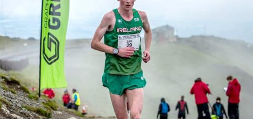
British Championship 2023: The Mourne Marauder
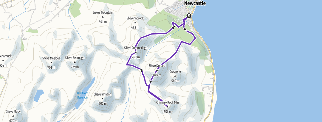
This year’s Northern Ireland Mountain Running Association British Championship race will start in Donard Park, Newcastle Co. Down on the 25th March 2023 at 11am. It will visit Slieve Donard Summit, Chimney Rock Mountain Summit and Slieve Commedagh Summit before returning to base in Donard Park, at approx 16km with at least 1200M of climbing.
The race is being run in memory of the airmen who lost their lives in WW2 plane crashes around the race route.
(1) On the lower slopes of Slieve Donard. A Wellington Bomber. (6 killed)
(2) On the summit of Chimney Rock Mountain. A (B-26) Marauder. (5 killed)
(3) On Slieve Commedagh, near the castles. De Havilland Mosquito. (2 killed)
(4) On Slieve Commedagh 150 feet from the summit. A Wellington Bomber (3 killed).
So when on the course spare a thought for the airmen who lost their lives some 80 years ago in the run up to the D. Day landings.
ENTRIES.
£25.00 per-entry by 13th March, a list of race entries will be published on the NIMRA web site. Fee includes refreshment, showers, car parking, use of Sportident (Si) race management/results system. All Si cards are provided and pre-logged onto the system; no personal Si cards(aka dibbers) can be used. Substitutions are not allowed.
No entries on the day. Teams free.
VENUE Donard Park, Newcastle, Co. Down, Northern Ireland. Parking, toilets and showers. GR373306.
Registration, refreshments and prize giving will be at Race HQ in Newcastle Baptist Church Hall, 17 Bryansford Road, Newcastle BT33 0HJ (as for last years championship race) which is 400m from Donard Park.
There are plenty of B&Bs, guesthouses and self-catering cottages in the area with Newcastle the main centre. Newcastle has a Youth Hostel and there is a well-appointed campsite at Tollymore Forest Park. Meelmore Lodge on the north side of the Mournes (GR305307) has a basic campsite, showers and a café. Other accommodation details are available from Tourist Information offices.
Newcastle Tourist Office, Central Promenade, Newcastle Co. Down, BT33 0AA. 028 4372 2222
E-mail newcastle@nitc.net
Tollymore Campsite 028 4372 2428
Meelmore Lodge 028 4372 6657
Newcastle YH 028 4372 2133
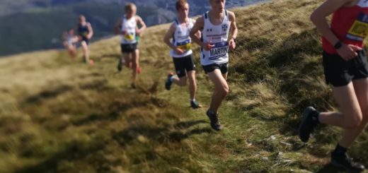
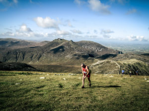
COURSE . The following description is for Guidance only.
This race starts at sea level in Donard Park and follows the forest road across Donard bridge then taking the rough cobbled path on the south side of the Glen river before turning south-east using the marked forest trails and paths to reach a small gate at the edge of the Quarry/Forest. Checkpoint 1. From the quarry, the main climb to the summit of Slieve Donard is next –almost 2000ft in 2km.Underfoot the terrain is mostly heather and grass with patches of boulders as it steepens towards the summit. You will first see the lesser cairn which is 250m before and 30m below Checkpoint 2 (at the large summit cairn ) beside the tower at the corner of the Mourne Wall. From here the route follows the Mourne wall in a southerly direction downhill to reach a stile which straddles the Mourne Wall at the Bog of Donard . Then head in a south easterly direction to reach Chimney Rock Summit Cairn. Checkpoint 3. Reverse the last section back to the Stile on the Mourne Wall. First aim for the North West Tors, probably passing on the North side and pick up descending paths towards the Stile . Having crossed the stile Checkpoint 4.you will pick up the Brandy pad.This track is very runnable and will take you past the western flanks of Slieve Donard and below the Castles of Commedagh where you will then meet a stepped path taking you to a Cairn on the Brandry Pad. Checkpoint 5. From here you will immediately begin to climb Slieve Commedagh’s steep grassy slopes in a North Easterly direction. You should aim to cross the Mourne wall once again using the Stile next to the stone tower near the summit. Slieve Commedagh Summit Cairn Checkpoint 6 is 150m due East of the tower across the flattish summit. All the climbing is over now. The route is then downhill all the way to the finish at sea level- almost 2,200ft in 4km. First descending from the summit in a Northerly direction before swinging east over Shanslieve. The next section to Checkpoint 7 at the stile on the edge of the forest is a mixture of grass and short heather with stony patches becoming steeper with some rock when approaching the forest. Take care on the descent if conditions are misty you will need a compass bearing as the ridge is both broad and deceptive. From the Stile a firebreak leads to small paths through Donard Wood to the finish in Donard Park. This section of the course from the stile at checkpoint 7 to the finish will be marked.
Note that all checkpoints must be visited in the following order: –
| Checkpoints | ||
| Start | Donard Park | Map ref. 373306 |
| 1 | Quarry/Gate | Map ref. 371292 |
| 2 | Summit Cairn Slieve Donard | Map ref. 358277 |
| 3 | Chimney Rock Summit Cairn. | Map ref. 364257 |
| 4 | Stile/wall-Bog of Donard | Map ref.354268 |
| 5 | Cairn/Brandy Pad. | Map ref. 342279 |
| 6 | Summit Cairn Slieve Commedagh. | Map ref. 346286 |
| 7 | Stile/Fire Break | Map ref. 363296 |
| Finish | Donard Park | Map ref. 373306 |
Maps covering the area of the race route are The Mourne Country Outdoor
Pursuits Map (LPS) and the Harvey Mourne Mountains Map 1:25,000
Full body cover including hat and gloves will have to be carried no matter what the weather conditions. Map, compass, whistle and some food will also be required in the compulsory kit and all runners kit will be checked at registration before receiving your race number and spot checked before the race can start.
As this is a challenging race you must be prepared for all eventualities; especially if the weather is bad as your navigation will be tested. If you do have to pull out tell a marshal and when you get back to Donard Park tell us again so that we know you are safely off the hills. For those who plan to carry a mobile phone the emergency contact number on the day will be 07490186683
Event Schedule
9.00 am Registration opens.
10.25 am Registration closes (sharp)
10.30 am Race Briefing.(outside race HQ)
11.00 am Race Starts.
1.00pm Refreshments available at race HQ.
3.30pm (Approx) Prize Giving.
5.00pm. Venue Closes.
TRAVEL
By air you can travel to Belfast City and Belfast International airports. Easy jet to Belfast International airport, BMI to Belfast City.
You can travel to Belfast and Larne by ferry from Cairnryan also Dublin/ Dun Laoghaire from Holyhead. Stena, P&O operate services.
P&O: 0870 24 24 777.www.poirishsea.com.
Stena: 08705 70 70 70. www.stenaline.co.uk.
MAP OF ROUTE
British Fell Championship Series 2023
25 March: Mourne Marauder, Northern Ireland (Medium)
1 July: Meall an t-Suidhe, Scotland (Short)
5 August: Maesgwm Detour, Wales (Medium)