World Police and Fire Games
“Where The Mountains of Mourne Sweep Down to the Sea” so goes the well known song by Percy French. What better way to describe the setting for this year’s World Police and Fire Games Mountain Race?
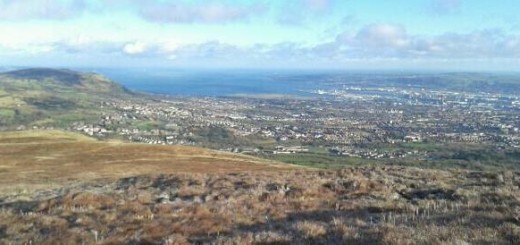
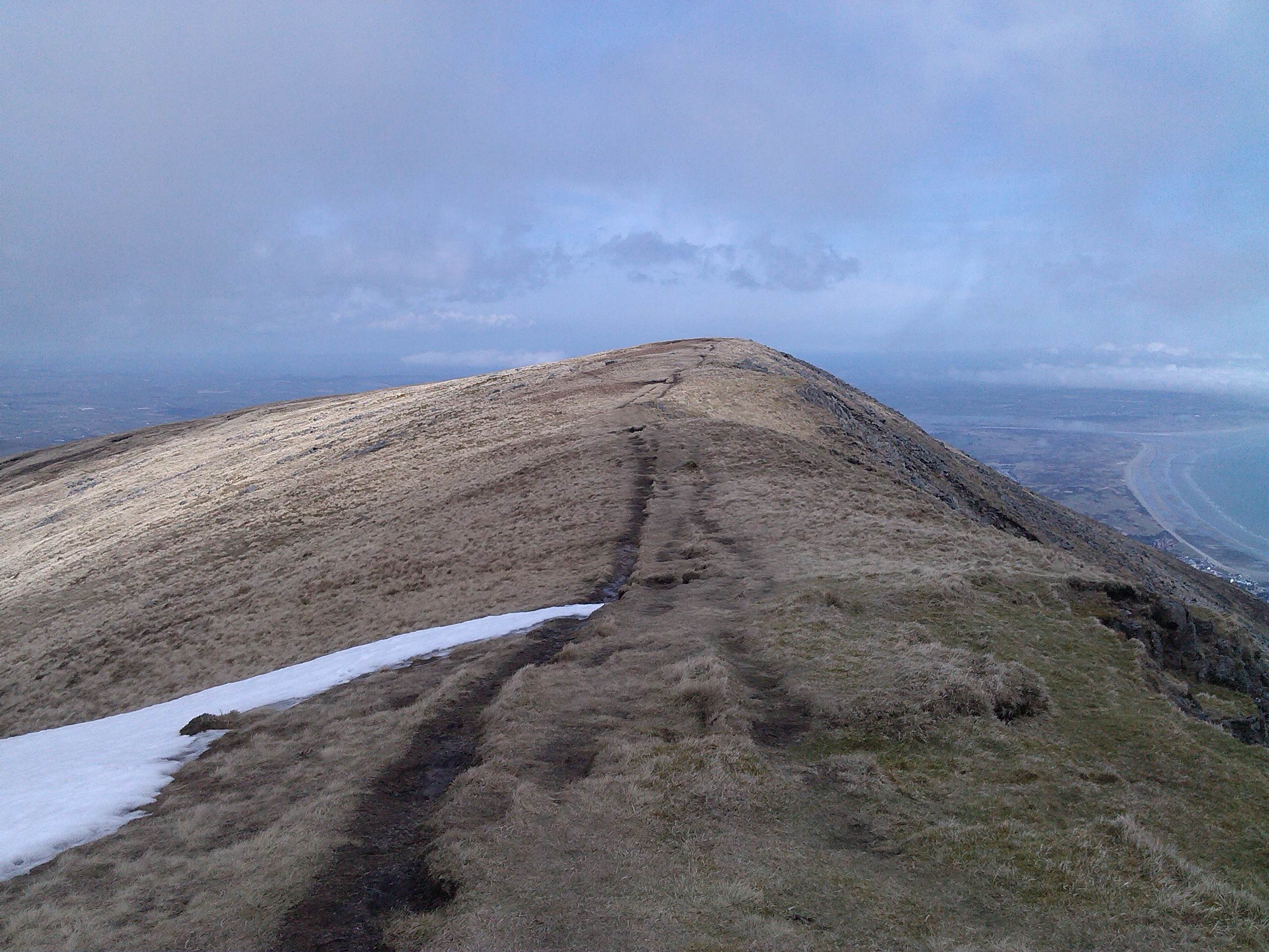
Slieve Donard is the highest mountain in Northern Ireland. It stands at 850m and together with the neighbouring peak of Slieve Commedagh (767m) it dominates the skyline above the coastal town of Newcastle in County Down.
This classic Mourne race will take you from sea level over these two majestic peaks and back to sea level. Are you up for the challenge?
There will be two events in the mountain running competition – The Donard and Commedagh Mountain Race and The Bogie Run.
EVENT SCHEDULE
| 7:00am | Registration for The Bogie Run opens |
|---|---|
| 9:20am | Registration for The Bogie Run closes |
| 9:30am | Race Safety Briefing for The Bogie Run |
| 10:00am | The Bogie Run Starts |
| 12:00pm | Medal Ceremony for The Bogie Run & Registration for The Donard & Commedagh Mountain race opens |
| 1:20pm | Registration for The Donard & Commedagh Mountain race closes |
| 1:30pm | Race Safety Briefing |
| 2:00pm | The Donard & Commedagh Mountain race starts |
| 5:00pm | Medal Ceremony for The Donard & Commedagh Mountain Race |
| 6:00pm | Venue Closes |
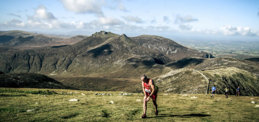
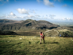
THE DONARD AND COMMEDAGH MOUNTAIN RACE
Distance 10.9 kms with 1,050m climb (for experienced hill runners only)
Fact File
Name – Donard and Commedagh Horseshoe
Area – Mourne Mountains
Distance – 10.9 kms / 1050m climbing
Start and finish – Donard Park – map ref. 373306
Suitability – experienced hill runners only
Skills required – basic map reading and navigational skills
Terrain – rough forest and mountain tracks. Open mountain where ground is mostly heather and grass with areas of boulders
Safety – all competitors must carry the following: windproof whole body cover (e.g. water resistant jacket and over trousers), hat, gloves, map, compass (suitable for navigating the course) and a whistle (race organisers will have a gear check before the start of the race and may disqualify entrants without the required gear.)
Map – activity map of the Mournes: 1:25,000. Published by Ordnance Survey Northern Ireland.
Course description
The ridge to Shanslieve
The race starts at sea level in Donard Park, following the forest road across the lower bridge and onto the rough path, on the south side of the Glen River.
The track continues to follow small paths through Donard Wood, emerging onto a higher forest road which climbs to the granite quarry. (Checkpoint 1: map ref. 371292). This section of the race course will be marked as far as checkpoint 1.
From the quarry, the main climb to the summit of Slieve Donard is next – almost 2,000ft in 2km. The terrain is mostly heather and grass, with areas of boulders as it steepens towards the summit. You will first see the Lesser Cairn, which is 250m before and 30m below the checkpoint (2) at the large summit Cairn, beside the tower at the corner of the Mourne Wall.
From this point, Slieve Commedagh is approximatley 1.6km away, with a 900ft descent to the col and a 600ft climb.
The Mourne Wall is followed to the col and for as far up Commmedagh as you decide, before heading out to the checkpoint (3) at the summit Cairn which is about 300m north east of the wall across the flattish summit.
It is a short run along the top edge of the Pot of Pulgarve, with a 250ft descent followed by a slight climb to Shanslieve.
The route is then downhill all the way to the finish at sea level – almost 2,200ft of descent in 4km. The section to the checkpoint (4) at the stile on the edge of the forest, is a mixture of grass and short heather with stony patches, becoming steeper with some rock when approaching the forest. Take care on the descent if conditions are misty; you will need a compass bearing as the ridge is both broad and deceptive.
From the stile, a firebreak leads down towards a forest road and descends onto small paths through Donard Wood, on the north side of the Glen River into Donard Park, and eventually to the finish. This section of the race course from the stile at checkpoint 4 to the finish will be marked.
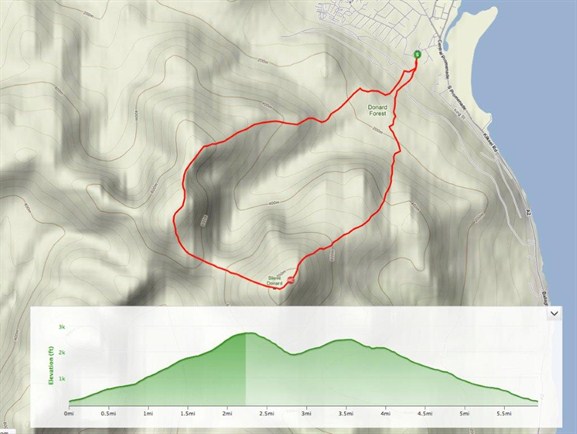
The Donard Commedagh GPS profile
For virtual views of part of the main race route click here!
Checkpoints
Start – Donard Park – Map ref. 373306
1. Quarry – Map ref. 371292
2. Summit Cairn Slieve Donard – Map ref. 357277
3. Summit Cairn Slieve Commedagh – Map ref. 346286
4. Stile / edge of forest – Map ref. 362296
Finish – Donard Park – Map ref. 373306
(All checkpoints must be visited in order)
THE BOGIE RUN
Distance 8kms with 400m climb (for less experienced competitors or those wishing to try this type of an event for the first time)
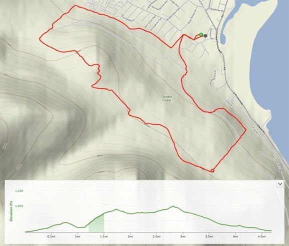
The Bogie Run GPS
The race is designed for those competitors who want to compete in a less serious undertaking, yet still seek to test themselves in a mountain environment.
Click here for a map of the Granite Trail
FACT FILE
Name – The Bogie Run (Mountain Trail Race)
Area – Mourne Mountains (Donard Wood)
Distance – 8kms/400m climbing
Start and finish – Donard Park – map ref. 373306
Suitability – anyone with a desire to run off road and up for a challenge
Terrain – rough forest tracks with short sections of grass and some granite steps
Safety – be prepared to carry a water resistant jacket and a whistle
Map – activity map of the Mournes 1:25,000 published by Ordnance Survey Northern Ireland.
Course description
Starting in Donard Park, the first section of this race follows the famous Granite Trail with a 1,100m climb up the old Bogie line (a 1:3 incline reaching the top of Donard Wood). From this point, follow the path to the view point at Thomas Quarry (checkpoint 1). Using the forest paths and trails in Donard Wood, visit checkpoint 2 (Drinnahilly view point) and Shepherd’s Lodge junction (checkpoint 3) returning to Donard Park along the marked lower paths.
This will be a marked course.
Checkpoints
Start – Donard Park – Map ref. 373306.
1. View Point (Quarry) – Map ref. 371292.
2. Drinnahilly View Point – Map ref. 362303.
3. Shepherds Lodge junction – Map ref. 357306.
Finish Donard Park – Map ref. 373306.