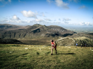
Silent Valley
Silent Valley, Northern Ireland Saturday 13th April 2013
British Fell and Hill Running Championship Event
Series sponsored by Pete Bland Sports & Norman Walsh Footwear
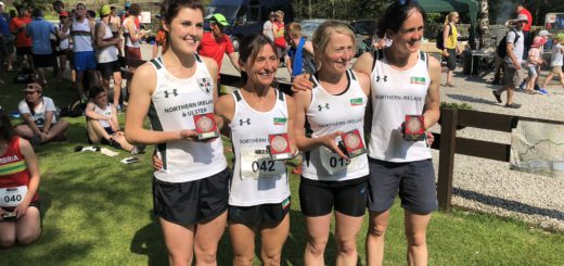
NIMRA Mountain Running Championship Event
Silent Valley Mountain Park, Mourne Mountains, 16km/1550m
Head Road, Kilkeel, County Down
Registration, parking, toilets GR 306210 Start 12 noon
Entry £12 by 5 April
Please enter using online facility on NIMRA website or by post using form available on website.
Teams free
Navigation skills required
Details: Ian Taylor
52 Bladon Drive
Belfast
BT9 5JN
028 9028 0790
ir.taylor@ntlworld.com
COURSE
Map: Mourne Country OSNI 1:25000
Start: Beside car park 307 211
1. Moolieve, 332m (marked route) 313 218
2. Slieve Binnian Summit Tor, 747m 320 234
3.Col Binnian / Lamagan, track junction 320 256
4.Doan, 594m 302 262
5.Carn Mountain, 588m 288 260
6.Slieve Muck, wall junction, 674m 281 250
7.Slievenaglogh, wall corner, 445m 299 229
8.Wall junction and crossing point 295 227
9.Stile approaching reservoir 302 221
Finish: Below Dam wall (marked route) 307 217
ENTRIES
Please enter online via the NIMRA website www.nimra.org.uk . Alternatively, you can enter by post using the form available on the website. Please pre-enter by 5 April as this helps our race administration. While entries can be made on the day, the cost is £15.
INTRODUCTION
This race was designed specifically for the British Championship and previously run in 2010. Silent Valley is on the south side of the Mournes about 12 miles from Newcastle and runs deep into centre of the high Mournes. The Valley contains two reservoirs which supply Belfast and the grounds have been developed as a park which is open to the public. There ample car parking and toilet facilities, also a cafe, visitors centre and marked walks. Please note that your race entry fee also includes car parking, so you do not have to pay the standard entry charge of £4.50 per car at the gate. Slieve Binnian, with distinctive tors along its ridge, dominates to the east, while Slievenaglogh, Slieve Muck, Carn and Doan lie to the west side.
There are several changes from the 2010 race. The start has been moved and there has been path restoration work on Binnian. Also, the prizegiving will be at Silent Valley after the race and refreshments/snacks will be available.
COURSE DESCRIPTION
The start will be in the reservoir grounds near the car park and not up on the southern slopes of Moolieve. The route out to the first checkpoint at the summit of Moolieve will be marked. Next is the main climb up Binnian, passing Wee Binnian on the way and the Mourne Wall can be followed for most of the 1500 feet to Slieve Binnian summit. Approaching the summit tors traverse across to the north, climb up to a small col between the tors and up to the checkpoint on top of the north most of the summit tors. From here it is north along the ridge of Binnian with great views if it is clear and you have time to look. There is a slight climb to the North Tor then about 800ft descent to the check point at the col with Lamagan. About two thirds of the way down the ridge narrows and there is a short rocky section to negotiate. Since the 2010 race there has been path restoration/improvement work along this whole section. Some details and photos of the path works can be viewed at www.mournelive.com/news
The next section to Carn Mountain will be familiar to all those who ran Mourne Peaks in 2008 as it is a reverse of that route. The run down to Ben Crom Dam is roughish but there is ongoing path restoration work here. After crossing the dam wall it is fairly rough underfoot for the 1200 foot climb up to the steep summit of Doan. After Carn Mountain there is a more gradual climb up to the checkpoint at the wall junction on the summit of Slieve Muck.
There are two steep sections descending Muck on the way to Slievenaglogh. About 100 metres after the summit the wall goes over a small crag, which can be easily negotiated by keeping out to the left/north of the wall at this point. About two thirds of the way down the wall runs over a longer section of rocky slabs so keep wide on either side to get past. It is shown on the map as a break in the wall.
After crossing the Bann’s Road there is flat boggy section. The 500 foot climb up Slievenaglogh is straight forward and follows the Mourne Wall, but likely to be tiring by this stage. Next descend south west over rocky ground for about 400 metres, keeping the wall to your left, to the next checkpoint at the wall crossing point.
Then it is south east across flattish ground for about 500m. There is only a vague track here and you cant see the reservoir or finish yet, so make sure you head south east as some people went astray here in 2010. Soon the finish should be in sight as you drop down alongside the wall, then fence to the checkpoint at a stile approaching the reservoir. A short section of rough ground leads to a track down to the corner of the dam. From here it is 400 metres across the dam to the tapes which will mark the short drop down the grass back of the dam wall to the finish. The race is at the longer end of the medium category as indicated by the course records.
Course records
1.43.56 Andrew Symonds 2.09.35 Philippa Maddams
PRIZEGIVING
At Silent Valley Mountain Park shortly after the race. Refreshments/snacks will be available.
There will not be anything formal at O’Hares in Newcastle, but we expect many folk will probably head there that evening for the usual craic.
ACCOMODATION
There are plenty of B&Bs, guest houses and self catering cottages in the region.
Newcastle is the main centre about 12 miles away while the town of Kilkeel is 4 miles
south of Silent Valley. Newcastle has a Youth Hostel and there is a well appointed
campsite at Tollymore Forest Park.
Less than three miles from the course is the Cnocnafeola Centre
Bog Road, Atticall, Kilkeel, Co. Down, BT34 4HT
T: +4428 417 65859 Mob: 07918197000
W: www.mournehostel.com E: info@mournehostel.com
Meelmore Lodge on the north side of the Mournes (GR 305 307) has a hostel, basic
campsite, showers and a café. It was the venue for the Mourne Peaks race in 2008.
The Lodge has a 32 bed self catering hostel. Rooms include 3 family with double and
bunks, 2 single and 1×10 beds and 1x 8 beds. It may be ideal for club groups. Camper vans will be welcome.
http://www.meelmorelodge.co.uk/
meelmorelodge@hotmail.co.uk
Meelmore Lodge 028 4372 5949 028 4372 6657 0793 466 6842
Newcastle Scouts Campsite is also available at Tipperary Woods (5 mins walk to
Newcastle Centre) – details from Deon McNeilly email deon@mournes.plus.com or
phone 028 4372 6618
Further details are available from Tourist information offices:-
Newcastle Newry
Central Promenade Town Hall
Newcastle Newry
Co Down Co Down
BT33 0AA BT35 6HR
tel: 028 4372 2222 028 3026 8877
fax: 028 4372 2400 028 3026 8833
e-mail newcastle@nitc.net
Newcastle YH 028 4372 2133 Tollymore Campsite 028 4372 2428
Websites www.kingdomsofdown.com
www.visitcoastofdown.com
E-mail info@kingdomsofdown.com
The Mourne Heritage Trust website www.mournelive.com gives a wide range of
information about the area.
TRAVEL
You can travel to Belfast and Larne by ferry from Stranraer, Cairnryan and Troon. Also
Dublin/Dun Laoghaire from Holyhead. Stena and P&O both operate services and it is
often worth shopping around for special offers.
P&O 0870 24 24 777 Stena 08705 70 70 70
www.poirishsea.com www.stenaline.co.uk
By air you can travel to Belfast City and International airports or Dublin. Easyjet fly to
Belfast International which is 15 miles to the north of Belfast.
MAP
The Mourne Country Outdoor Pursuits Map is published by Ordnance Survey Northern
Ireland.
Tel 028 9025 5755 Fax 028 9025 5700